

 (Photo by iStock/FOTOGRAFIA INC.)
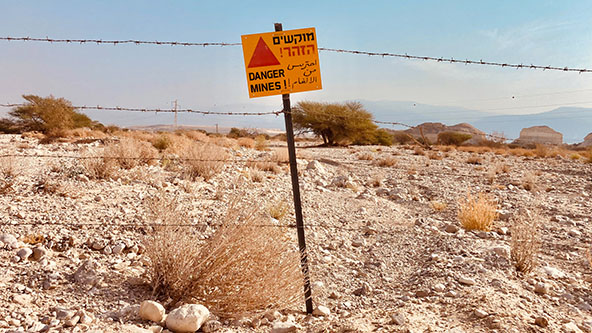
Even decades after a conflict ends, the danger posed by land mines remains. Mines and explosive remnants of war killed more than 2,000 people and injured thousands more in 2021, according to Landmine and Cluster Munition Monitor. The International Committee of the Red Cross (ICRC) estimates that there are more than 100 million antipersonnel and undetonated land mines in the ground worldwide. Because they are often disbursed from airplanes, their precise locations are indeterminable.
Governments and NGO teams on the ground can detect and remove land mines, but only if they know where to check. And the costly process, ICRC weapon-contamination consultant Martin Jebens notes, means that sending personnel to places found to be free of land mines is ultimately a waste of resources. “You want to be as precise as possible in finding these areas,” he adds, “because then you can clear them fast, and it will be more effective.”
At a 2019 ICRC event, Jebens met Benjamin Butcher, a global-relations manager at the Japanese IT and electronics firm NEC Corporation, and the two discussed the difficulty of identifying likely areas of land-mine contamination. Butcher believed that NEC’s expertise in AI could help the hardworking teams on the ground carry out their difficult, dangerous task.
Currently, areas likely to contain land mines are identified by teams of experts evaluating a range of data, from records of battlefields and police reports of casualties to images of craters and the locations of strategic features such as rivers and settlements.
This time-consuming data-collection process could be simplified with AI, Butcher realized, through the method of “data harmonization,” which aggregates “all this information together and turn[s] it into usable data,” and in an accessible format.
NEC and the ICRC began this work in June 2021 by partnering with scientists at Waseda University in Tokyo, who were already working on de-mining with drones that relied on AI-based image-recognition technology. Each partner supplies staff and technology at their own cost, with NEC’s team in Tokyo and ICRC’s teams in Geneva and Denmark.
Between April and October 2022, the partners launched a test project in a region where land mines were known to be present. The AI was informed with and trained on geographical and geological information, the location of infrastructure and other important buildings, and the sites where land mines were previously found.
The AI analyzed the data to predict the locations of land mines, which ground teams searched to confirm its findings. Ernö Kovacs, the senior manager for the IoT Group at NEC Laboratories Europe, says the AI achieved a 90 percent accuracy rate for both probable land-mine areas and those areas likely to be land-mine-free.
The team now hopes to complement the static data, which characterizes the environment, with dynamic data such as human intelligence and reports. NEC is also beginning to incorporate more remote-sensing data from satellites and drones, as well as information from photographs and videos from social media, into the data-harmonization process.
They also intend to test the system in other regions and eventually establish standards for the safe sharing of sensitive data with users. NEC is considering a variety of business models for offering the system to NGOs and governments for real-world use by March 2024, after testing is completed.
“Potentially, you can use this method on a country-wide level, and you will find areas that have been contaminated,” Jebens says. “In the future, you won’t have to wait until someone actually steps on a mine to find these contaminated areas and make them safe for people again.”
Read more stories by Emma Woollacott.